During the Course we created Maps according to this objectives:
Defining Potential Limits to urbanization - Based on “Postmetropolis” project: post metropolitan territories as emergent forms of urban space that have to deal with Compute percentage of Land use in 3 Alpine catchments: River Brembo; River Serio and River Adda in Valtellina;
Mapping the change in crop cultuvation near Milan; Using satellite data (sentinel 2 data);
Mapping the accessibility to green areas in Milan ;
Digitalize historical maps assigning specific attributes to each layer ( buildings, roads, defensive structures, rivers and gardens;
Compute the river basin catchments from a Digital Terrain Model using Qgis toolboxes and SAGA library;
Update and validate Data comparing them with OSM;
Identify and map entrance points to parks and green area; Define an index to identify areas with low, medium and high level of accessibility in Milan parks;
Create a heatmap of religious buildings density characterized by artistic value, filtered according to different distances and travel criteria.
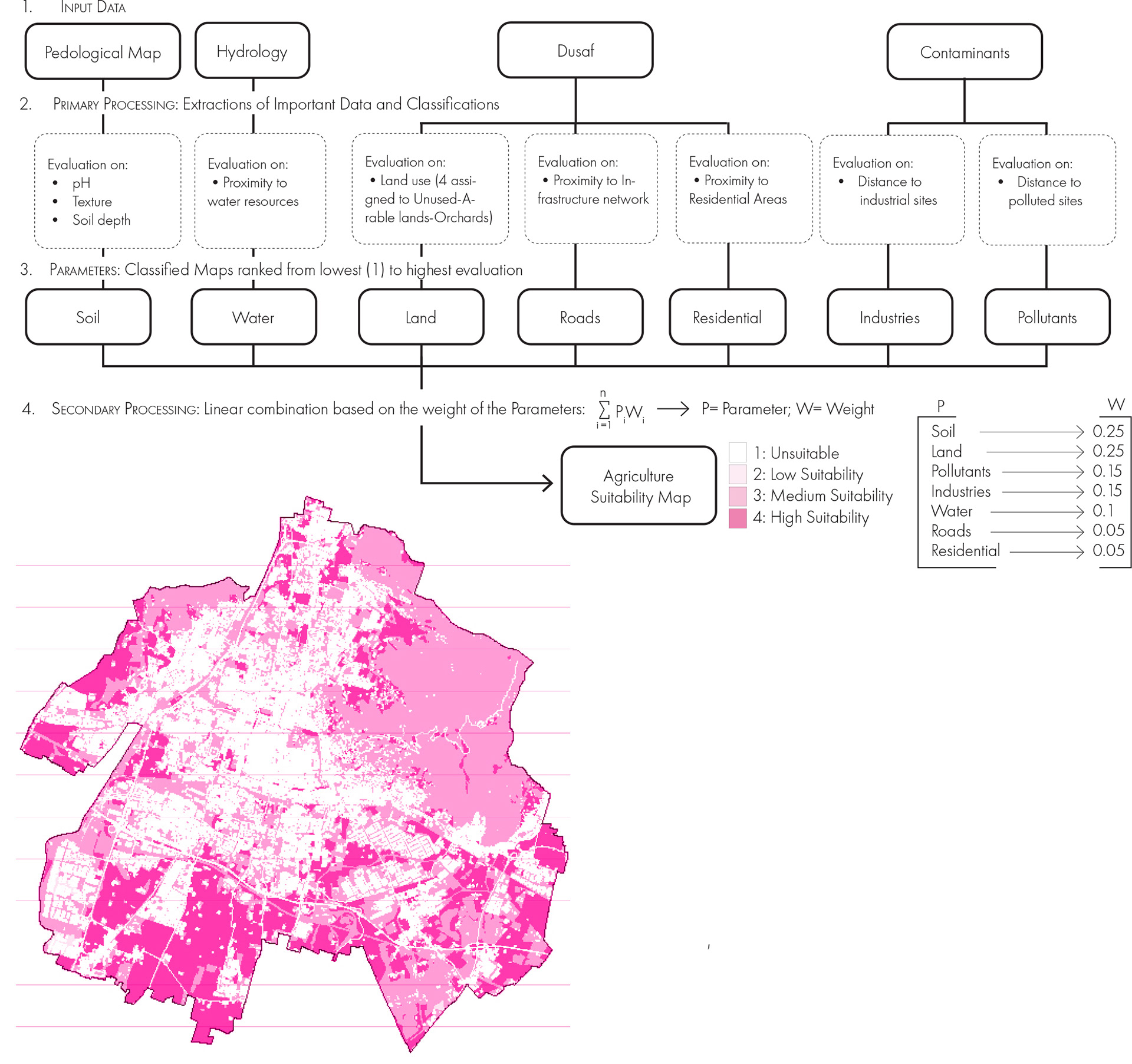
Lastly we were asked to develop our own methodology to better understand and analyze a chosen topic. In our case we decided to deepen the theme of Urban Agricolture. CITY SUSTAIN-ability is our project to assess land suitable for urban agriculture in Brescia. The analysis starts by collecting the initial data from 4 layers: Soil, Water elements, DUSAF and Contaminants. The first step was to process the Pedological Map of Brescia in terms of pH, texture and soil depth, aiming to categorize the soil according to the areas that are more and less suitable for urban agriculture. From this first categorization we evaluated the different spaces in relation to the proximity of water sources, contamintans and infrastructures.
CITY SUSTAIN-ability